
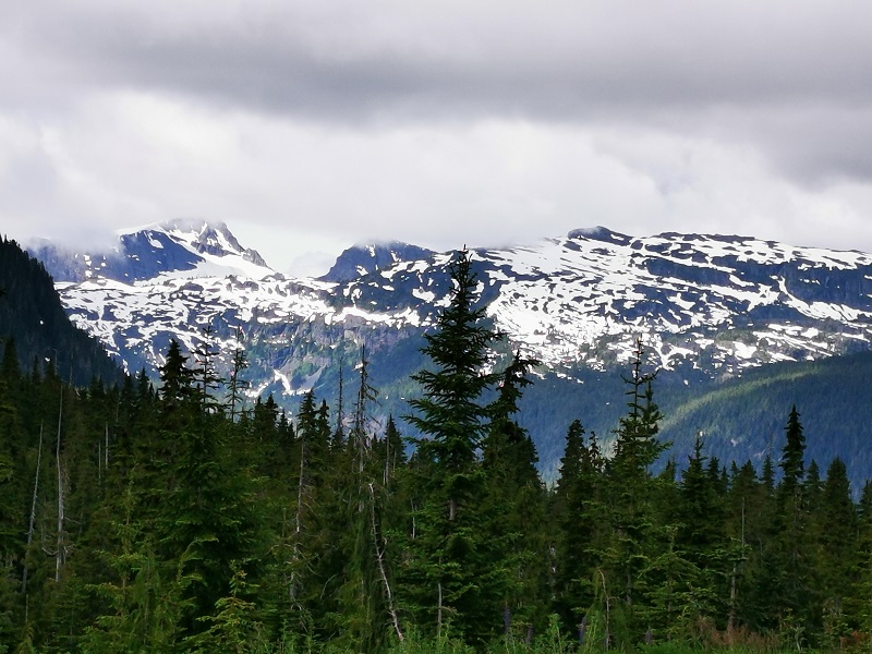
The Sophia Range is a low small group of mountains on Nootka Island. Visiting the range would be fascinating overlooking inlets. The spectacular sights of the hills wrapped in trees ornamented with beautiful wildlife and birds are amazing while ascending. The range and the nearby park are a wealth of outdoor activities as paddling, fishing, and wildlife viewing.
The Genevieve Range offers a fascinating tour within Nootka Island with spectacular sights for mountaineers. The range's area is a remote paradise for those seeking peace and seclusion. While ascending peaks, the range allows breath-taking sights of the ocean, enormous trees below your feet covering hills along with lakes and creeks dotted the area and plenty of wildlife.

Did you know that the Refugium Range serves a variety of interests? It allows you to spend your time far from crowds and busy life. Adventure kickers choose the Refugium Range wilderness area for hiking and exploring the real beauty. It is where they complete outdoors and scale mighty peaks. Mountaineers can pitch a camp through the secluded wilderness.
Although the city is known for its gold mining, Zeballos is a fantastic destination for paddling activities. Great hiking trail within the rainforest in which various wildlife is observable. Kayakers and canoeing followers may have the chance to explore a place with several underground caves and spelunking places. Not to mention that other outdoor activities can add to your joy in Zeballos.
Give rewards to yourself for working hard all week and plan to visit Fair Harbour to kill kayaking opportunities. Fair Harbour is an oceanic kayaking zone with all the necessary equipment to surf the water. Besides, you can find great recreational locations around and check all the activities on your to-do list.
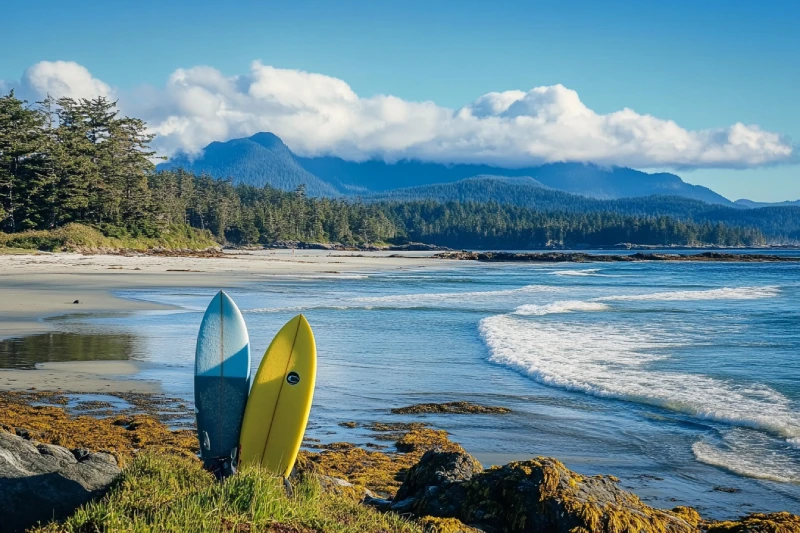
Rebuild your imagination about surfing while you are having a great time in the Kyuquot Sound area, an area of world-class beaches and reefs. Featuring amazing natural scenery which can cheer you up while you are skimming the surface of the water. The beautiful sandy beach features an eye-catching view that can trigger you to camp and surf on one of the largest campsites on Vancouver Island.
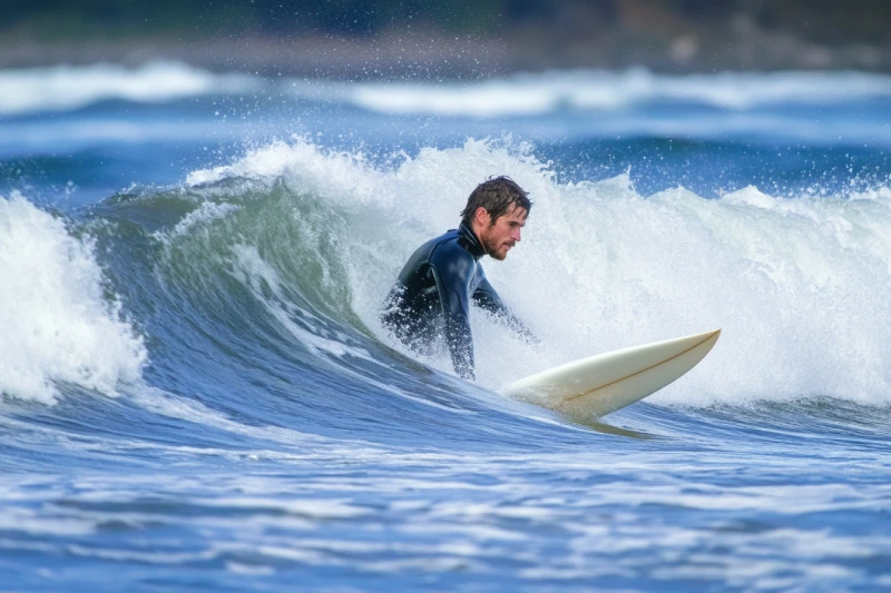
Get out of your comfort zone and get away from the bustles in towns; Nootka Island has a lot to offer to make your vacation count. A place of amazement and glory, the waters of the most oversized island located off Vancouver Island give you a once-in-a-lifetime opportunity for surfing. Nestled near Vancouver Island, Nootka Island features breathtaking scenery you can let your spirit feed on it.


.webp)


The Sophia Range is a low small group of mountains on Nootka Island. Visiting the range would be fascinating overlooking inlets. The spectacular sights of the hills wrapped in trees ornamented with beautiful wildlife and birds are amazing while ascending. The range and the nearby park are a wealth of outdoor activities as paddling, fishing, and wildlife viewing.

If you desire to search for hidden parts of nature to discover exciting facts, Coral Cave is a suitable option. Before stepping into it, you need to have caving skills. The beauty of the cave is doubled by the stunning rainforest that surrounded the entrance. While you are inside, you may see the flooded parts of the cave. Let's get into it to find more and realize the time effect for thousands or millions of years.
Have a visit to Mquqᵂin/Brooks Peninsula Provincial Park, the only survivor of the last ice age on Vancouver Island. How is it interesting? With species of plants that are not found anywhere else! The wilderness area is calling nature lovers to discover the wonders. Accessing the beach, alpine, and subalpine regions are some distinctive features to have an unforgettable experience.
The Genevieve Range offers a fascinating tour within Nootka Island with spectacular sights for mountaineers. The range's area is a remote paradise for those seeking peace and seclusion. While ascending peaks, the range allows breath-taking sights of the ocean, enormous trees below your feet covering hills along with lakes and creeks dotted the area and plenty of wildlife.
Did you know that the Refugium Range serves a variety of interests? It allows you to spend your time far from crowds and busy life. Adventure kickers choose the Refugium Range wilderness area for hiking and exploring the real beauty. It is where they complete outdoors and scale mighty peaks. Mountaineers can pitch a camp through the secluded wilderness.