If you try exploring what you haven't seen yet on Vancouver Island, Barkley Sound might be a good start. After decades of close observation and research, humans realize the importance of killer whales as a means of tourism attraction. therefore, to start your adventure in Barkley Sound, keep its fantastic whale watching opportunities in mind.
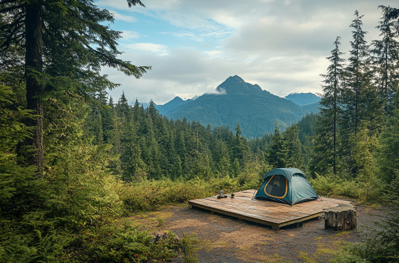
The fundamental core of life is your thirst for adventure; therefore, visiting Circlet Lake is a must. Circlet Lake Campground has enough attraction to fascinate you. Alpine forest, easy access, waterfalls, and lakes are just some attractions bewitching visitors and mountaineers for camping there. Some wooden plateau tent pads are provided on the lake, while some are off the lake for campers who need more seclusion.
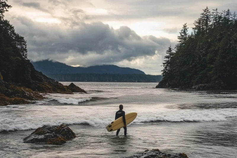
Write a diary now, but save your memories to review for the rest of your life. Assign one page to the adventure you will experience in Raft Cove Provincial Park. Nothing can be fascinating as much as a beach you can surf and camp on simultaneously, but the sandy beach there provides that for you. Low tides at Raft cove will motivate you to get on a surfing board and make your day meaningful.
The old-growth forest on Vancouver Island's east coast maintains a great campground to spend a night. The Telegraph Cove Campground spoils the guests and visitors with colourful buildings, wonderful ocean-view, and a beautiful campground and resort with a spectacular atmosphere. Also, campsites and accommodations are facilitated for your convenience.
Even your imagination cannot give a preview of how beautiful Ten Mile Point Diving is. So, if you want to guarantee the immortality of your memories in this spectacular diving zone, do not forget o bring your cameras. The living species under these cold high-wave waters add up to the attractiveness of the diving adventure there.
Make your diving experience memorable by going to the Browning Pass Diving zone. Browning Pass cold waters provide you with ample and undeniable opportunities to dive deep and observe the spectacular life under the surface. Comprising a rare beautiful nature, you can take images with an imaginary background.
If you are trying to get away from your lethal daily routine and your adventure flow has been stopped, why don't you plan a trip to the only multi-functional port city on Vancouver Island, Nanaimo? An assemblage of several distinguished bodies of water has made Nanaimo one of the best paddling locations in the world. You are provided with tons of other activities on both land and the sea.
As one of the best tourist attractions of Sooke and Vancouver Island, West Coast comprises many outdoor excitements that cannot be denied. You are provided with different wildlife to watch and various food to eat, not to mention that you observe a rare nature that is outstanding. So, chances are high to see different whales and other marine creatures.
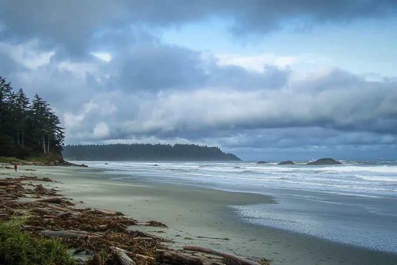
As one of the main recreational spots in the Pacific Rim National Park Reserve, Long Beach features strong waves pounding the beach. This quality has made this beautiful scenic beach a hot spot for surfing and storm-watching enthusiasts. It is a beautiful and pristine beach on which having a lounge time or walking feels rejoiced. You can lose yourselves in the sand of Long Beach and find them once again.

Whether you decide to go diving, you can head to Saanich Inlet and plunge in the waters whenever you desire. However, if you visit this inlet, you may choose to dive from a floating boat. The diverse underwater life you are given a chance to observe is another merit of diving in Saanich Inlet.
Tahsis is an accessway to many hiking trails. This village municipality is situated at the top of the steep-sided Tahsis Inlet and is surrounded by breathtaking wilderness and abundant wildlife. Some of the best water activities like ocean kayaking, surfing, windsurfing, recreational fishing or sport fishing, scuba diving, and kiteboarding are popular.

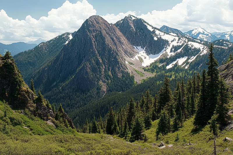
The Sutton Range is a group of mountains and a subrange of the Vancouver Island Ranges that form the greater Insular Mountains. The amazing rock formation and alpine scale make the mountains within the range perfect for climbing. While you're atop Sutton Peak, Victoria Peak, Warden Peak, and mainland coast mountains are within your sight.
The Sophia Range is a low small group of mountains on Nootka Island. Visiting the range would be fascinating overlooking inlets. The spectacular sights of the hills wrapped in trees ornamented with beautiful wildlife and birds are amazing while ascending. The range and the nearby park are a wealth of outdoor activities as paddling, fishing, and wildlife viewing.
As it is said, "A river cuts through rock, not because of its power, but because of its persistence." Did you know it takes a long process for a cave to be created? Artlish Caves is no exception. It is the largest active river cave in Canada, and the running water is why these series of caves were carved out from the ground, which is still happening. While you are inside the caves, sharpen your eyes to find bats, spiders, and other creatures in the darkness.

If you desire to search for hidden parts of nature to discover exciting facts, Coral Cave is a suitable option. Before stepping into it, you need to have caving skills. The beauty of the cave is doubled by the stunning rainforest that surrounded the entrance. While you are inside, you may see the flooded parts of the cave. Let's get into it to find more and realize the time effect for thousands or millions of years.
Devote more time, get a challenging goal for yourself, and pack your equipment. It is time to face the longest and deepest cave on Vancouver Island, Thanksgiving Cave. Caving inside this mostly tight and beautiful cave is not a beginner's suitable exploration, but for an expert caver, the adventurers' rush worth any trouble. If you are a beginner, don't worry. Tahsis is the caving capital of Canada, so you have different chances nearby.
Going deep into the forest is worthy enough to visit the stunning Upana Caves. Listen to the sound of a river passing by and detect several entrances with the famous one behind the spectacular Upana Caves Waterfall. Inside entrances, you may find birds' nests. Watch the evidence of years of existence by holes like the one in cheese. The stunning galleries and passages you'll explore while going down would be incredible.
The Genevieve Range offers a fascinating tour within Nootka Island with spectacular sights for mountaineers. The range's area is a remote paradise for those seeking peace and seclusion. While ascending peaks, the range allows breath-taking sights of the ocean, enormous trees below your feet covering hills along with lakes and creeks dotted the area and plenty of wildlife.
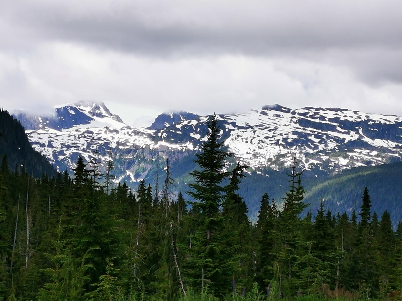
The Haihte Range overlooking Tahsis and Zeballos is home to some of the largest remaining glaciers on Vancouver Island. It experiences many cloudy days due to being close to the coast. The high terrain, including long aesthetic lines, is perfect for skiing at the lower glacier shelves, and visitors would enjoy excellent alpine climbing at jagged spires along the main ridge.


.webp)


|
Month |
Weather Conditions |
Trail Accessibility |
Considerations |
|---|---|---|---|
|
May
|
Variable; cooler temperatures with increased rainfall.
|
Cooler water, potentially choppier due to spring storms.
|
Less crowded; prepare for wet and cold conditions. Kayakers should be ready for rain and colder water.
|
|
June
|
Mild temperatures; moderate rainfall.
|
Warming water, moderate conditions.
|
Increasing number of kayakers; moderate weather. Good for those preferring milder conditions.
|
|
July
|
Warmer temperatures; drier conditions.
|
Warm water, calm seas.
|
Peak season; higher demand for rentals and guides. Ideal for the best weather and water conditions.
|
|
August
|
Warm temperatures; drier conditions.
|
Warm water, calm seas.
|
Peak season; still busy but possibly less crowded than July. Great for families and groups.
|
|
September
|
Cooling temperatures; increased rainfall.
|
Cooling water, potential for rougher seas.
|
Less crowded; prepare for variable weather. Experienced kayakers or guided tours recommended.
|
Booking Ucluelet kayaking tours is straightforward with operators like Majestic Ocean Kayaking and Hello Nature Adventure Tours (hellonature.ca). Online reservations are available, with half-day tours starting at $89 and multi-day trips (e.g., Broken Group Islands) up to $1,295. “Booked a day in advance—super easy,” says a 2023 TripAdvisor reviewer. Summer (May-September) fills fast, so reserve 2-4 weeks early, per Tourism Ucluelet. Contact operators directly for custom trips: Majestic (+1-800-889-7644) or Hello Nature (+1-250-726-2035).
|
Aspect |
Rating |
Comments |
|---|---|---|
|
Guides
|
4.9/5
|
“Knowledgeable, enthusiastic, made us feel safe”
|
|
Equipment
|
4.8/5
|
“Modern kayaks, comfy gear”
|
|
Wildlife
|
4.7/5
|
“Seals, eagles, bears—unforgettable sightings”
|
|
Scenery
|
5.0/5
|
“Breathtaking harbour and island views”
|
|
Safety
|
4.9/5
|
“Thorough briefings, beginner-friendly”
|
|
Value
|
4.6/5
|
“Worth every penny for the experience”
|

Alireza Moghimehfar