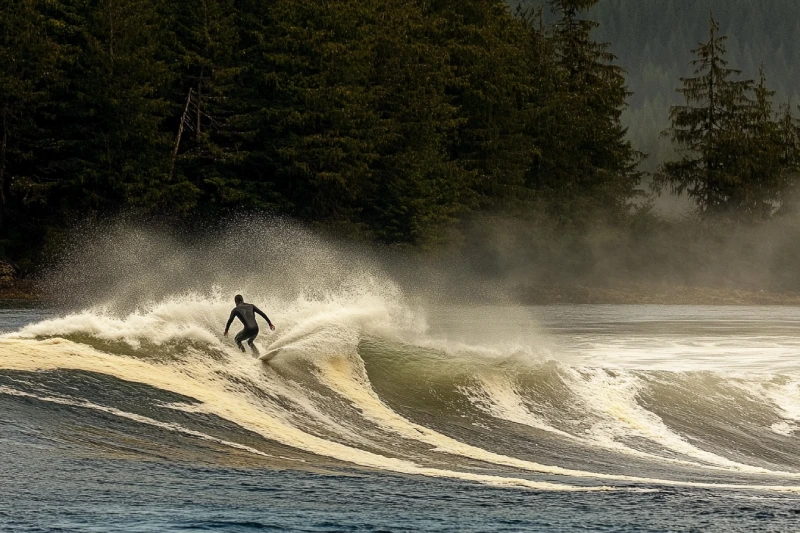
Take one step into the path of travelling, and next, you find yourself miles away from home. While you are exploring the adventure center of North America, do not forget to check out one of the world's most beautiful coastlines. Port Renfrew, aka The Jewel of the West Coast, is one of the hot spots for windsurfing and surfing. Enclosed by majestic mountains and trees, the town is where you can have fun doing recreational activities.
Stretch your minds and imaginations to a different experience of kayaking by going to Quatsino Sound. As a mysterious place, it is known as underground caverns, and it offers undeniably chances for those in love with paddling. While you are on the water and paddling the smooth waves, you may be lucky and observe some marine creatures that can add to your joy.
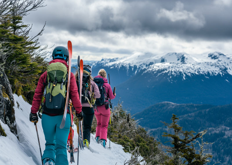
As the only community-owned and operated ski resort, Mount Cain has heavy snowfall in winter, making it an ideal place to experience winter activities. The breathtaking slopes of Mount Cain, besides various trails and logging roads, multiply the skiing attractiveness in this location. The drier snow condition of Mount Cain makes it a better place for spring skiing.
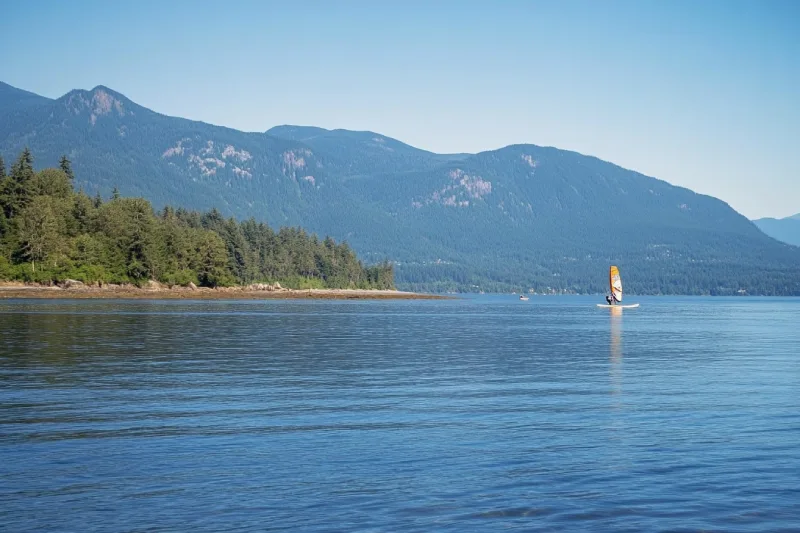
Discover your windsurfing spirit while you are in the Deep Bay area. Waterfowl in the winter months have made these protected waters a hot spot for windsurfing. Due to Deep Bay's proximity to Baynes Sound, visitors can enjoy several other outdoor adventures. Also, more recreational opportunities are provided in the park and the golf club nearby.
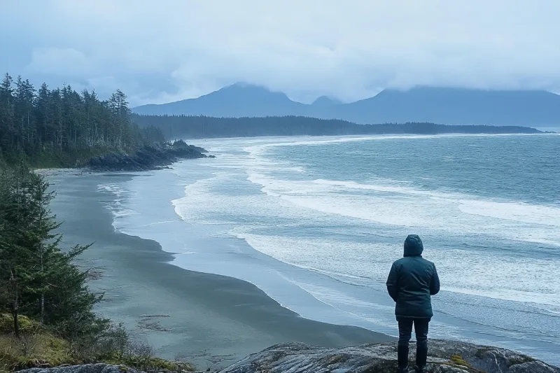
After a long relaxing time on Cox Bay Beach, away from all the stress from urban life, if your souls are looking for excitement, the storm-watching opportunity provided for you may be able to satisfy that need. This clean and peaceful beach offers you a pristine view of the sunset and the chance to watch the surfers skimming the water. It is a good idea to walk and feel the sand upon your feet.
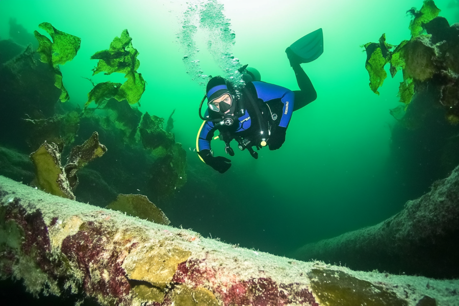
Just a short distance from downtown Nanaimo, you will find fantastic diving opportunities available all year round in Tyee Cove. You can choose the depth you are willing to dive in based on your proficiency level; plus, you are given a chance to explore the marine life inhabiting this diving zone.
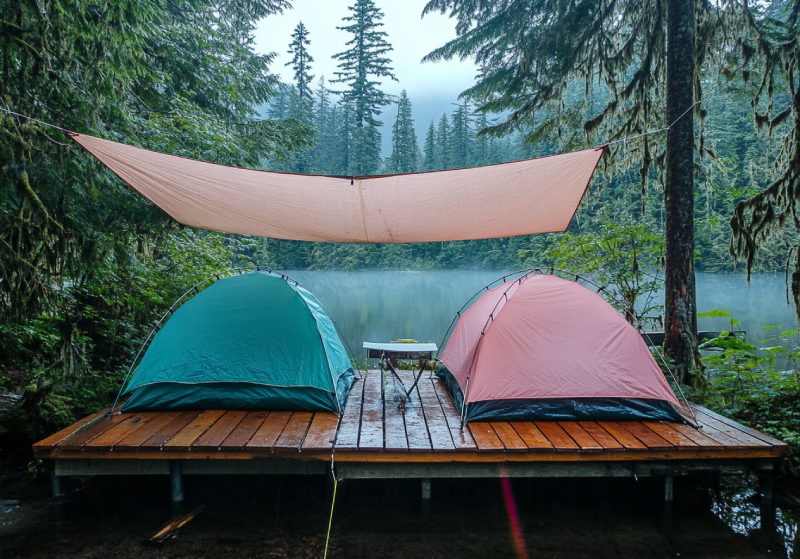
Located in the Strathcona Provincial Park near Bedwell Lake, camping is possible in a nice backcountry campground on Baby Bedwell Lake, set in the lush forest surrounded by majestic mountains. Beautiful alpine forest, perfect swimming, breathtaking view of the trail, small ponds and lakes surrounded by glacial mountain peaks are some of the area's attractions. They are enough to fascinate visitors and campers.
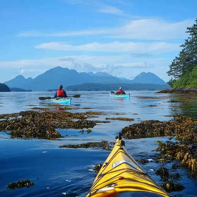
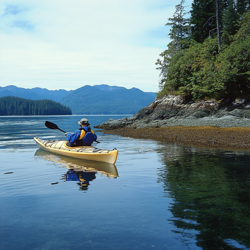
Imagine gliding across the serene waters of Ucluelet Inlet, enveloped by dense forests, with eagles soaring overhead and sea lions playfully breaking the surface nearby. Welcome to kayaking in Ucluelet—a breathtaking adventure on Vancouver Island’s rugged west coast that blends tranquility with wild beauty. Whether you’re new to paddling or a seasoned kayaker, this inlet offers an unforgettable escape into nature, complete with historic sites and abundant wildlife.
This guide is your roadmap to the perfect Ucluelet Inlet kayaking trip. From the best launch points and scenic highlights to safety tips and local insights, we’ve got you covered. Get ready to explore hidden coves, spot bears along the shore, and paddle through a landscape steeped in coastal charm—your next adventure awaits!
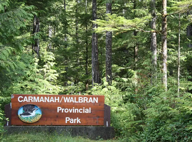
Hiking in Carmanah Walbran Provincial Park on Vancouver Island, British Columbia, Canada, is an adventure into a 16,450-hectare wilderness of old-growth forests and giant trees. This provincial park, a top pick for hiking trails Vancouver Island, offers the best hiking and wilderness camping experiences in Canada. Whether you’re driving from Vancouver, BC, on a road trip, exploring day trips from Lake Cowichan, or seeking things to do on Vancouver Island, Carmanah Walbran Provincial Park delivers. With Carmanah Valley’s towering Sitka spruce and Walbran Valley’s rugged park trails, this hiking guide covers trail maps, safety tips, camping details on Vancouver Island and all the details for your next Canada trip.
If you are looking for a place to make immortal memories of your windsurfing experience, Esquimalt Lagoon would be an ideal place to do so. As one of the seven migratory bird sanctuaries, this lagoon with clear shallow water provides you with ample opportunity for water activities, including windsurfing. Also, beautiful birds travelling between North and South America are observable.


.webp)


Tahsis is an accessway to many hiking trails. This village municipality is situated at the top of the steep-sided Tahsis Inlet and is surrounded by breathtaking wilderness and abundant wildlife. Some of the best water activities like ocean kayaking, surfing, windsurfing, recreational fishing or sport fishing, scuba diving, and kiteboarding are popular.

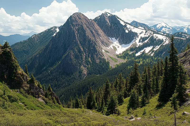
The Sutton Range is a group of mountains and a subrange of the Vancouver Island Ranges that form the greater Insular Mountains. The amazing rock formation and alpine scale make the mountains within the range perfect for climbing. While you're atop Sutton Peak, Victoria Peak, Warden Peak, and mainland coast mountains are within your sight.
The Sophia Range is a low small group of mountains on Nootka Island. Visiting the range would be fascinating overlooking inlets. The spectacular sights of the hills wrapped in trees ornamented with beautiful wildlife and birds are amazing while ascending. The range and the nearby park are a wealth of outdoor activities as paddling, fishing, and wildlife viewing.
As it is said, "A river cuts through rock, not because of its power, but because of its persistence." Did you know it takes a long process for a cave to be created? Artlish Caves is no exception. It is the largest active river cave in Canada, and the running water is why these series of caves were carved out from the ground, which is still happening. While you are inside the caves, sharpen your eyes to find bats, spiders, and other creatures in the darkness.

If you desire to search for hidden parts of nature to discover exciting facts, Coral Cave is a suitable option. Before stepping into it, you need to have caving skills. The beauty of the cave is doubled by the stunning rainforest that surrounded the entrance. While you are inside, you may see the flooded parts of the cave. Let's get into it to find more and realize the time effect for thousands or millions of years.
Devote more time, get a challenging goal for yourself, and pack your equipment. It is time to face the longest and deepest cave on Vancouver Island, Thanksgiving Cave. Caving inside this mostly tight and beautiful cave is not a beginner's suitable exploration, but for an expert caver, the adventurers' rush worth any trouble. If you are a beginner, don't worry. Tahsis is the caving capital of Canada, so you have different chances nearby.
Going deep into the forest is worthy enough to visit the stunning Upana Caves. Listen to the sound of a river passing by and detect several entrances with the famous one behind the spectacular Upana Caves Waterfall. Inside entrances, you may find birds' nests. Watch the evidence of years of existence by holes like the one in cheese. The stunning galleries and passages you'll explore while going down would be incredible.
The Genevieve Range offers a fascinating tour within Nootka Island with spectacular sights for mountaineers. The range's area is a remote paradise for those seeking peace and seclusion. While ascending peaks, the range allows breath-taking sights of the ocean, enormous trees below your feet covering hills along with lakes and creeks dotted the area and plenty of wildlife.
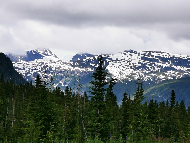
The Haihte Range overlooking Tahsis and Zeballos is home to some of the largest remaining glaciers on Vancouver Island. It experiences many cloudy days due to being close to the coast. The high terrain, including long aesthetic lines, is perfect for skiing at the lower glacier shelves, and visitors would enjoy excellent alpine climbing at jagged spires along the main ridge.
|
Month |
Average High Temp (°F) |
Average Low Temp (°F) |
Average Rainfall (inches) |
Days of Rain |
Sunshine Hours (Daily Avg) |
|---|---|---|---|---|---|
|
May
|
. 58
|
47
|
3.0
|
9.2
|
~6 (from climate data)
|
|
June
|
61
|
51
|
2.5
|
7.7
|
~7 (from climate data)
|
|
July
|
65
|
54
|
1.4
|
4.5
|
~8 (from climate data)
|
|
August
|
66
|
54
|
1.5
|
4.9
|
~8 (from climate data)
|
|
September
|
63
|
51
|
3.3
|
8.2
|
~6 (from climate data)
|

Anita Akhondi