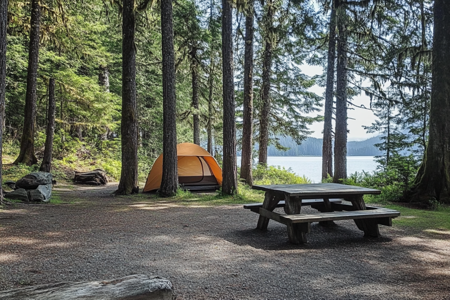
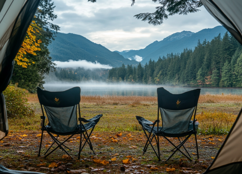
Nothing can feed your spirit like a clean, relaxing vacation. To do so, you have fantastic chances to camp in Newcastle Island Marine Provincial Park Campground and let your lungs to be flourished by the fresh air you let in. These oceanside campgrounds have a lot to offer: ample amenities, various wildlife and astonishing scenery. Camping at this campsite is something that happens once in a lifetime.
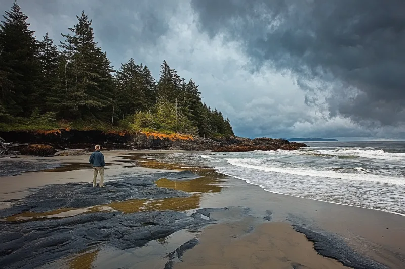
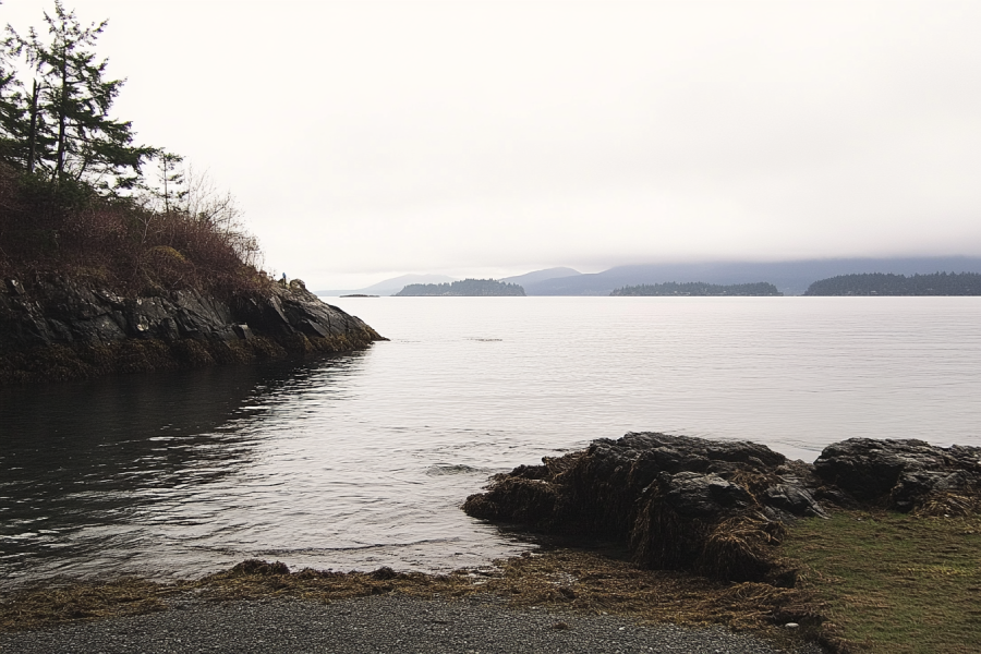
Let the magnificent storms in Botanical Beach touch your souls. The fabulous beach known for its wonderful intertidal sea life has majestic waves during the windy seasons, making it a popular destination for those fond of storm watching. Try to visit this beach at low tide to enjoy seeing lovely sea-life creatures.
.jpg)
The Courtenay Riverway Heritage Walk makes it possible for you to hike in a paved path where nature is around you. It is easy to find wildlife for photography while hiking. Take your dog with you and choose between hiking, walking, running, and biking. As the trail is suitable for all ages and is close to Courtenay, it is one of the popular hiking trails in the area that gets crowded on sunny days.
Make your time on Vancouver Island count and go diving in Elliot's Beach Park. It is a pristine diving location for professional diving, but it has opportunities to discover underwater for ordinary folks.
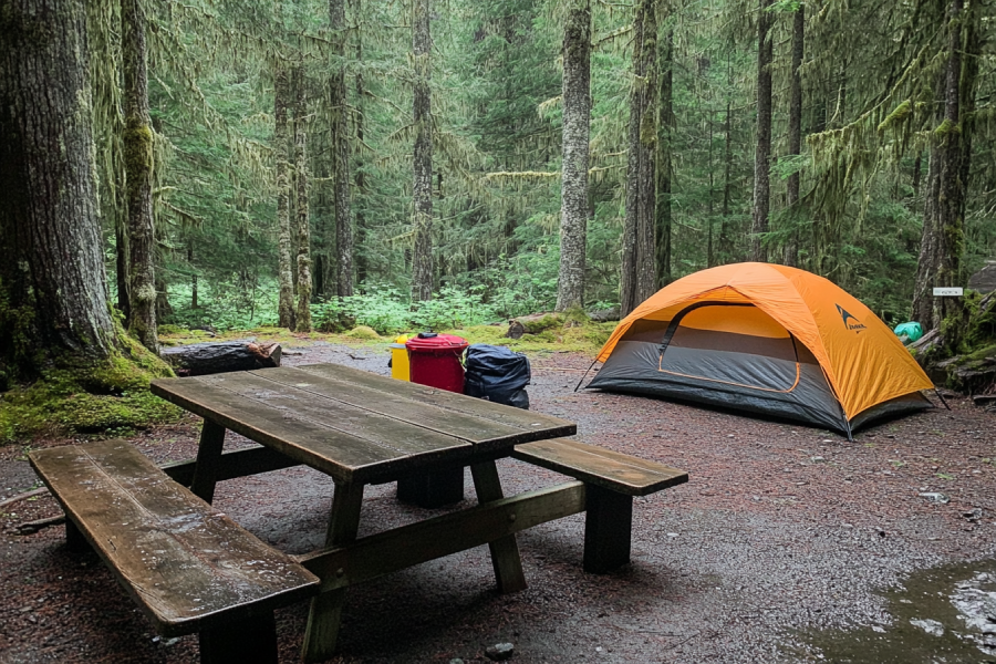
As the oldest provincial park on the island, Strathcona Provincial Park Campground will be a memorable wilderness adventure. Every day you spend on this beautiful campground is a different new day, for you can experience any adventure and never get sick of it. As a hot spot for camping, you are given a chance to choose the setting of your campsite.
.jpg)
A relatively short and easy trail in the Comox Valley area is the hike to Trent Falls. Stay on track because its wild nature has much to offer. Hiking along the Trent River with its perfect swimming and fishing opportunities and watching the waterfall with a deep pool under and the wildlife around it brings you joy, especially if you are with the family.
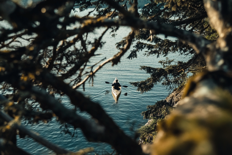
Although Port Renfrew is primarily used for forestry and fishing, it is ideal for kayaking. The mountainous range, oceanic weather, and Mediterranean rainfall patterns make Port Renfrew one of the best locations for family holidays and a once-in-a-lifetime opportunity for kayaking. One of the merits of kayaking in these waters is the opportunity to see wildlife and birdlife on board.
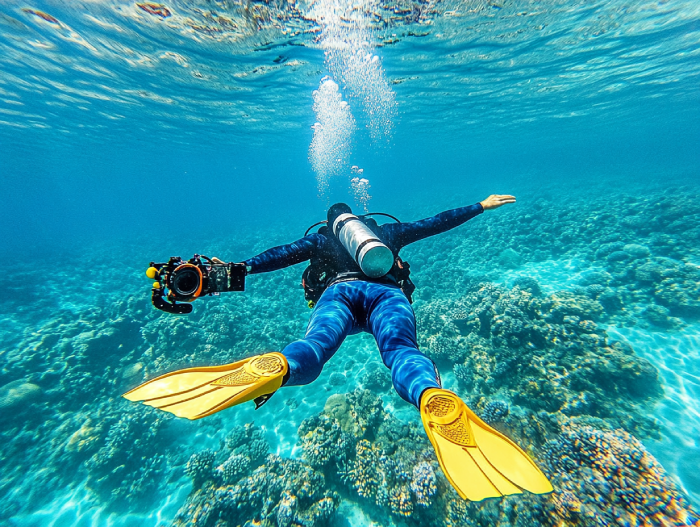
Extraordinary opportunities to make your diving experience memorable in the heart of Greater Victoria, including high-ranked spots for diving. These spots provide you with inevitable diving opportunities which allow you to explore the alien underwater world of Victoria's waters saturated with magnificent creatures. Do not miss it for the world.
Home to many campsites with all kinds of facilities and services right on the shoreline, Buttle Lake campground offers you the best opportunities to explore the shore. There you can do a lot of activities and enjoy seeing marine creatures.
Annually, the campground welcomes RV and vehicle campers. Also, you can have a good time camping in your tents.
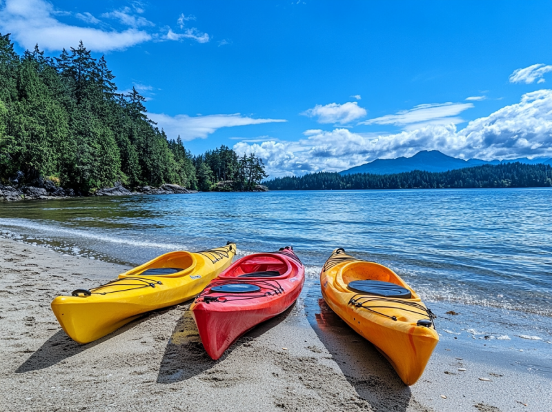
If you are a paddling enthusiast and happen to visit Vancouver Island during summer times, put Shawnigan Lake on top of your list. The lake is enclosed with fabulous parks in which you are provided with tons of recreational activities. Lakeside cabins, several beaches and a spectacular shoreline make Shawnigan Lake a fantastic hot spot for kayaking and canoeing.


.webp)


Tahsis is an accessway to many hiking trails. This village municipality is situated at the top of the steep-sided Tahsis Inlet and is surrounded by breathtaking wilderness and abundant wildlife. Some of the best water activities like ocean kayaking, surfing, windsurfing, recreational fishing or sport fishing, scuba diving, and kiteboarding are popular.

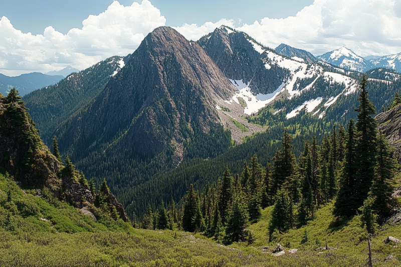
The Sutton Range is a group of mountains and a subrange of the Vancouver Island Ranges that form the greater Insular Mountains. The amazing rock formation and alpine scale make the mountains within the range perfect for climbing. While you're atop Sutton Peak, Victoria Peak, Warden Peak, and mainland coast mountains are within your sight.
The Sophia Range is a low small group of mountains on Nootka Island. Visiting the range would be fascinating overlooking inlets. The spectacular sights of the hills wrapped in trees ornamented with beautiful wildlife and birds are amazing while ascending. The range and the nearby park are a wealth of outdoor activities as paddling, fishing, and wildlife viewing.
As it is said, "A river cuts through rock, not because of its power, but because of its persistence." Did you know it takes a long process for a cave to be created? Artlish Caves is no exception. It is the largest active river cave in Canada, and the running water is why these series of caves were carved out from the ground, which is still happening. While you are inside the caves, sharpen your eyes to find bats, spiders, and other creatures in the darkness.

If you desire to search for hidden parts of nature to discover exciting facts, Coral Cave is a suitable option. Before stepping into it, you need to have caving skills. The beauty of the cave is doubled by the stunning rainforest that surrounded the entrance. While you are inside, you may see the flooded parts of the cave. Let's get into it to find more and realize the time effect for thousands or millions of years.
Devote more time, get a challenging goal for yourself, and pack your equipment. It is time to face the longest and deepest cave on Vancouver Island, Thanksgiving Cave. Caving inside this mostly tight and beautiful cave is not a beginner's suitable exploration, but for an expert caver, the adventurers' rush worth any trouble. If you are a beginner, don't worry. Tahsis is the caving capital of Canada, so you have different chances nearby.
Going deep into the forest is worthy enough to visit the stunning Upana Caves. Listen to the sound of a river passing by and detect several entrances with the famous one behind the spectacular Upana Caves Waterfall. Inside entrances, you may find birds' nests. Watch the evidence of years of existence by holes like the one in cheese. The stunning galleries and passages you'll explore while going down would be incredible.
The Genevieve Range offers a fascinating tour within Nootka Island with spectacular sights for mountaineers. The range's area is a remote paradise for those seeking peace and seclusion. While ascending peaks, the range allows breath-taking sights of the ocean, enormous trees below your feet covering hills along with lakes and creeks dotted the area and plenty of wildlife.
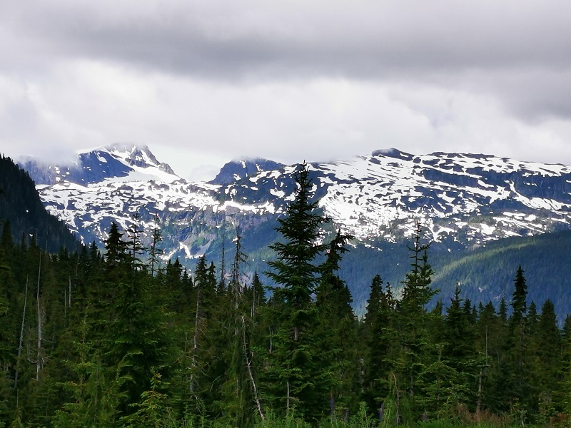
The Haihte Range overlooking Tahsis and Zeballos is home to some of the largest remaining glaciers on Vancouver Island. It experiences many cloudy days due to being close to the coast. The high terrain, including long aesthetic lines, is perfect for skiing at the lower glacier shelves, and visitors would enjoy excellent alpine climbing at jagged spires along the main ridge.
|
Month |
Weather Conditions |
Trail Accessibility |
Considerations |
|---|---|---|---|
|
May
|
Variable weather; cooler temperatures with frequent rain.
|
Water levels may be lower and high tide conditions less predictable—portage challenges may arise.
|
Fewer paddlers; be prepared for wet, slippery banks and the need for careful tide planning.
|
|
June
|
Mild temperatures with moderate rainfall.
|
Generally stable high tide conditions ensure optimal water levels for entering the canyon smoothly.
|
Ideal for intermediate to advanced paddlers; check tide charts and be alert to potential afternoon winds.
|
|
July
|
Warm and drier conditions.
|
Ideal water levels and high tide favor easy canyon entry; calm conditions prevail in the morning.
|
Peak paddling season; expect increased demand for permits and accommodations.
|
|
August
|
Warm with minimal rainfall.
|
Optimal water and tide conditions; calm mornings allow safe navigation before afternoon winds develop.
|
High demand season; plan ahead and monitor weather forecasts for any sudden shifts.
|
|
September
|
Cooling temperatures with occasional rain.
|
Water levels begin to fluctuate; maintaining high tide is critical to avoid lengthy portages.
|
Less crowded; variable conditions require extra preparedness for sudden weather changes.
|

Alireza Moghimehfar