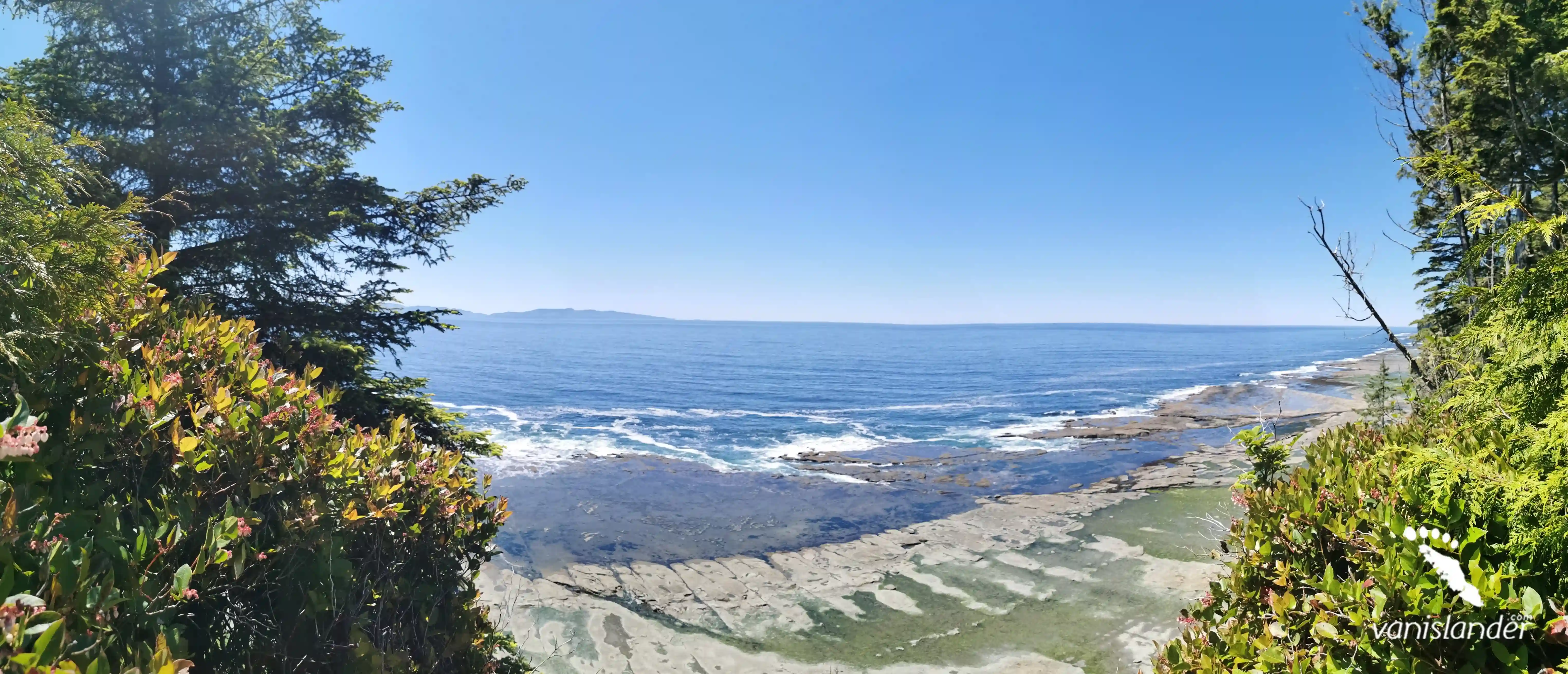
Chesterman Beach, also known as Chestie Beach, is one of Vancouver Island's most visited beaches. It would be the first stop for visitors who explore the area. You will see the scenic and quiet extension of a long beach, separated into north and south by a tombolo.
The beach is known for its glorious stretch of pristine sands and aquatic creatures back and forth, slightly after the low tide pools. Well-favoured sea stars, mussels, and anemones would attract your attention.
Spending daytime exploring when the sun is warming the ocean or camping at night while the stars are painting the dark blue sky above the beach will make your experience unforgettable.
A mixture of wave sound with birds and rare eagles flying over the ocean can take you on a mysterious journey; just close your eyes and imagine it all. The high and low waves of the Pacific Ocean made an excellent chance for surfing and riding on the ocean's surface with various skill levels. If you are a fan of water activities, don't forget to bring your wetsuit with you. Describing it all wouldn't do it any justice; see for yourself.
Chesterman Beach is located on the West Coast, almost in the middle of Vancouver Island and near The Carving Shed museum. Islands like Vargas Island and Meares Island surround it. If you look up at the map, you can find Chesterman Beach about 122 km (76 miles) west of Port Alberni and 4.7 km (3 miles) away from downtown Tofino. The beach is available by taking Pacific Rim Highway in the north and south Chesterman. One of the nearest beaches to it is Long Beach in the southeast, about 13.5 km (8.3 miles) away. Going 2.2 km (1.3 miles) to the south, you can have the chance to explore one of the hidden gems of Tofino, the Low Tide Sea Cave.
Chesterman Beach can be found less than a kilometre (0.6 miles) from Tacofino, the well-known taco restaurant. There are washrooms with a freshwater shower and toilets as well. You can find this oceanfront spot so convenient while surrounded by satisfying dining spots and accommodations. Here, there are services, such as The Pointe Restaurant, by providing a cozy environment with a fantastic view of the ocean, and the Chesterman Hideaway with free Wi-Fi and breakfast. All are here to make sure you'll have a peaceful time at the beach.
From Nanaimo:
Getting to Chesterman Beach from Nanaimo is possible via BC-4 W. It is 203 km (126.1 miles) and takes about 2 hours and 50 minutes.
Head west on Fitzwilliam St toward Wesley St and go for 800 m (2624.6 ft). Continue onto Third St and after 1.9 km (1.2 miles), continue onto Jingle Pot Rd. Follow 650 m (2132.5 ft) and turn right onto BC-19 N (signs for Campbell R). Drive 41.3 km (25.6 miles) and take exit 60 toward Port Alberni. After 1.5 km (0.9 miles), the road merges onto Memorial Rd/BC-4 W. Continue to follow BC-4 W. Drive 128 km (79.5 miles) and turn right onto Pacific Rim Hwy/BC-4 W. After 28.4 km (17.6 miles), turn left onto Lynn Rd. Follow the road for 500 m (1640.4 ft) to reach Chesterman Beach.
From Victoria:
The fastest route to reach Chesterman Beach from Victoria is via Trans-Canada Hwy/BC-1 N and BC-4 W. It is 314 km (195.1 miles) and takes about 4 hours and 20 minutes.
Head west on Pandora Ave toward Government St and follow for 99 m (325 ft). Turn right onto Government St. After 1 km (0.6 miles), slight right toward Trans-Canada Hwy/BC-1 N. Continue for 72 m (236.2 ft) and use any lane to turn left onto Trans-Canada Hwy/BC-1 N. Drive 104 km (64.6 miles). Use the right two lanes to merge onto BC-19 N via the ramp to Parksville/Campbell River. After 49.7 km (31 miles), take exit 60 toward Port Alberni. 1.5 km (0.9 miles) ahead, the road merges onto Memorial Rd/BC-4 W. Continue to follow BC-4 W and drive 128 km (79.5 miles). Turn right onto Pacific Rim Hwy/BC-4 W. Continue 28.4 km (17.6 miles) more and turn left onto Lynn Rd. After 500 m (1640.4 ft), you will reach Chesterman Beach.
Are you into stretching your legs for a bit? Pack your things up because Tofino includes scenic and excellent hiking trails among the forests. There is no designated trail, but as soon as you start hiking toward the beach, you can feel the wildlife while passing through the towering trees and beautiful nature. It's a good idea to start from Sunset Bench at Middle Beach to Bella Pacifica Campground. On the way, you can feel the boardwalk and tree's shadow, which keeps you off the sun glow in the daytime. About a kilometre (0.6 miles) just over the trees in the south appears Chesterman Beach with all its beauty.
Chesterman Beach gets its name from John Phillip Chesterman, a white settler. He was living in Canada in the early 20th century. In 1901 he and his wife lived on a homestead in the middle of Vancouver Island, on the inlet side, crossed the beach. At that time, John Chesterman was a budding prospector trying to make money by developing a copper and gold mine on Meares Island. Records show that he obtained land grants from the British crown back in 1915. Despite the early goals of settlers like Chesterman, this beach is now a popular tourist destination in late spring and summer.
Chesterman Beach attracts many tourists with motives like hiking, bird watching, camping, whale watching, or anyone willing to be close to the pure, spectacular landscapes of Chesterman Beach. Some people prefer end-to-end walks along the beach with their pets. Simultaneously, others enjoy watching the cute novice and professional surfers in summer or the storms riding with waves challenging the rocks around the neighbour Frank Island during the winter. Soft sands create an excellent opportunity for little kids and their families to build sandcastles while enjoying marine life close to their feet. Relaxing and meditating can suit many tastes in the cold seasons. Don't miss watching the incredibly vibrant sunset in the north end of the beach, just in time when sands turn into purple and blue at the edge of dawn. We believe that you will plan to return to the area.