

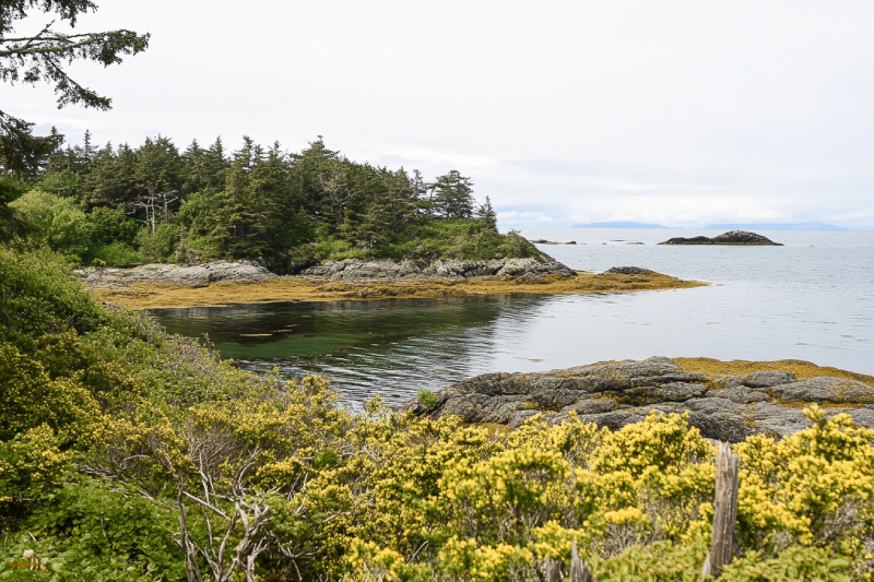
Race Rocks Ecological Reserve was established to preserve intertidal and subtidal communities that became very rich due to strong tidal currents. It features marine mammals like whales, sea lions and seals, birds like ducks, cormorants, black oyster-catchers and bald eagles. Fish species, marine invertebrates, and animals like marine algae and seagrass are among other inhabitants.

French Beach Provincial Park is the perfect combination of a pebble beach, a lush forest, and the blue ocean. Step into the French Beach Trail and choose your camp between tent and RV sites. Watch marine wildlife on the beach or birds flying over your head. With Juan de Fuca's Strait view, you may have chances to see migrating gray whales in spring and fall.
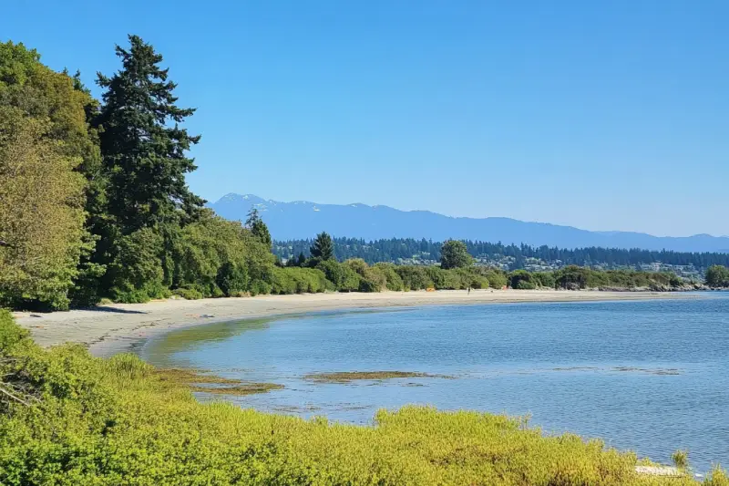
On the west coast of Vancouver Island, Jordan River Regional Park is a scenic place nestling among coastal hemlock, fir and cedar trees. The park features a long cobble shore and the Juan de Fuca Strait with a fantastic overlooking of the Olympic Peninsula. Locating on the ocean side made it a perfect choice for swimming, kayaking, and surfing.
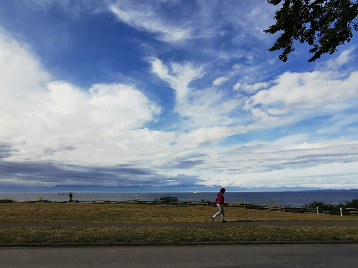
If you are looking for a kid-friendly place in Victoria, Willows Park is an ideal option. The park has a stunning view of Mount Baker and features a lovely, soft, and sandy beach. Experience a great time swimming, sunbathing, reading books, picnicking, and kayaking. Walk, run, or relax on the sand and let your kids play on the beach or the playground nearby.
At the northwest shore of West of Shawnigan Lake, there is a dawn to dusk area, with a Douglas fir forest and a delightful beach known as Shawnigan Lake Provincial Park. Being there with your family and friends and spending your time swimming, canoeing, waterskiing, and windsurfing would refresh your body and soul. The park is a habitat for many animals.
Elk/Beaver Lake Regional Park, with a wide variety of species of flora and fauna, features two lakes, a forest, a playground for kids, and picnicking area. That is why you can do lots of water-based and land-based activities. Among them are swimming, fishing, paddling, windsurfing, waterskiing, hiking, cycling, and horseback riding. This park is a birds' paradise.
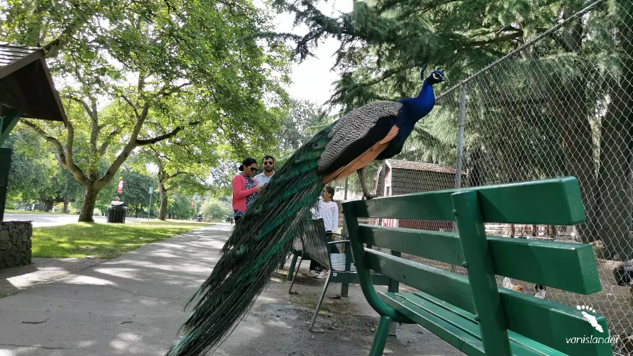
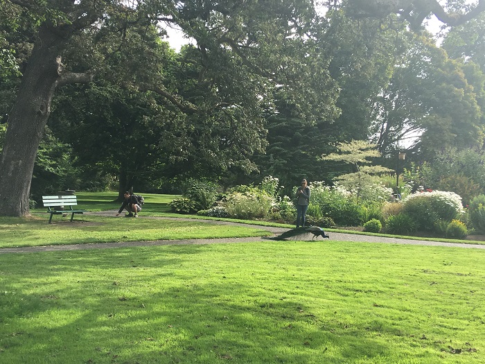
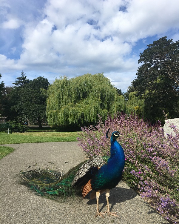
Beacon Hill Park, a popular destination among locals and tourists, has spectacular views, charming woodlands, Rose Garden, roaming peacocks, many unique wooden sculptures, and facilities. It has four ponds famous for turtles, swans, ducks, blue herons, and Canada geese. River otters, raccoons, squirrels, and birds live here. A petting zoo, two playgrounds, two spray parks, and tennis courts are available.
Memory Island Provincial Park is one of the smallest parks in British Columbia. Its peaceful and beautiful nature makes it an excellent choice for picnicking. As it is placed in Shawnigan Lake, you can catch some fish like trout. Also, swimming, canoeing, and kayaking are possible. In addition, the park is home to various birds, small mammals, reptiles, amphibians, plants, and fungi.
Goldstream Provincial Park is an old-growth temperate rain forest with 600-year-old Douglas fir trees. It has magnificent waterfalls, giant trees, and a winding river, a perfect area for camping. Annual fall salmon that runs in the river and the bald eagles that gather at the park for feeding are some of the most exciting views. With a variety of trails, this park is an excellent place for hiking.
Mount Douglas Park is the largest and most fascinated park in the Saanich area, with breathtaking 360-degree panoramic views of the majestic mountain, island, and ocean. It is known for its age-friendly hiking trails lush with plenty of trees and wildflowers. Walking through its sandy beach and the tremendous forest lets you experience peace and enjoy the wildlife.
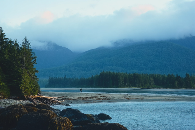
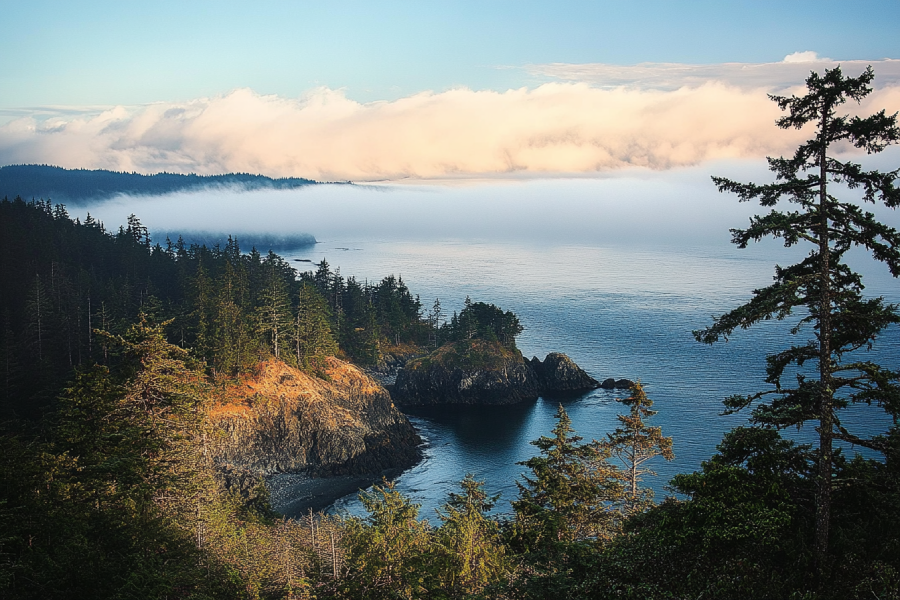
Answer the call of nature and step into breathtaking trails while watching wildlife. Excellent hiking trails on the beach with a fantastic ocean view will get you to East Sooke Regional Park. With its 1,435 hectares of natural and protected coastal landscape, feel the real nature at the west coast of Vancouver Island, where all attractions await visitors.
.jpg)
Wear decent hiking boots for a moderate hiking trail near Sooke. It is not for the faint of heart, but it is an enjoyable trail that leads you to Grass Lake and featuring Monument Mountain makes it possible to have amazing views from the top. Doing the Grass Lake Trail overnight and camping by the lake turns it into a memorable trip. Enjoy the trail in warmer seasons and get a dip into the lake.
.jpg)
It is time to put your heart into hiking and step into a moderate multi-use trail with some great views along the way and on top. Mount Manuel Quimper has a beautiful summit worth the climb, which gives you excellent vistas of Sooke Harbour and a chance to visit one of the last fire lookouts left on the island.
.jpg)
Here is a highly recommended and well-marked trail for challenges enthusiasts. Hiking on Mount Empress from Sooke Potholes via Mary Vine and Todd Creek Trails offers you insane 360° views of the Sooke Basin, Victoria, and San Juan Islands.
.jpg)
Hiking on the entire East Sooke Coastal Trail is an experience not to be missed! This beautiful trail is a mix of the fantastic coast and beautiful greenery. Hiking boots are required! The route takes you along bluffs and cliffs by the Pacific Ocean that worth it for the views. This well-marked trail can take full-day hiking in East Sooke Regional Park.
.jpg)
The East Sooke Coast and Interior Trail Loop is a well-marked trail with beautiful scenery. It is a combination of an easy access road and a more challenging coastal pass, which offers you incredible viewpoints. This excellent trail is along the Pacific Ocean and allows you to see marine life such as whales from a distance.
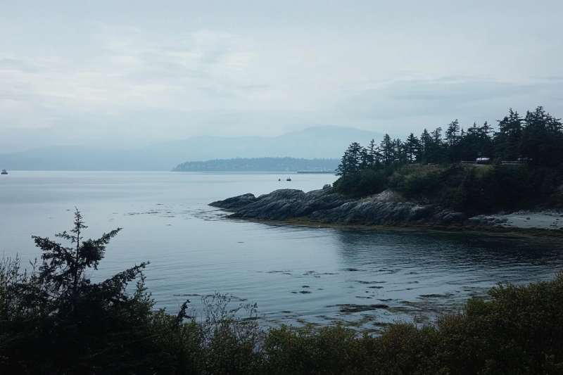
While exploring Sooke Area, if you happen o take a long calm walk on the Otter Point shoreline, you may see whales from the beach. Otter Point Park provided you with other activities, too, such as hiking, wildlife and birdwatching, and also a scenic nature to appreciate.
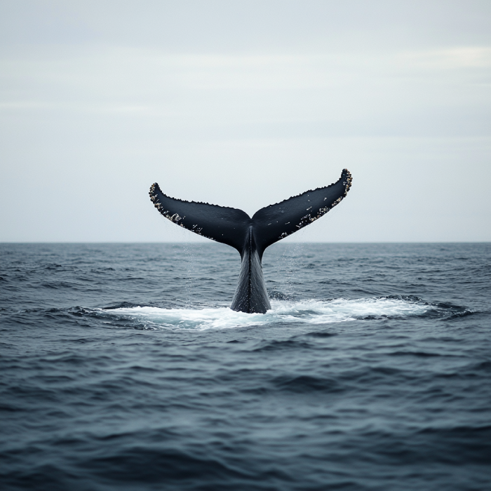
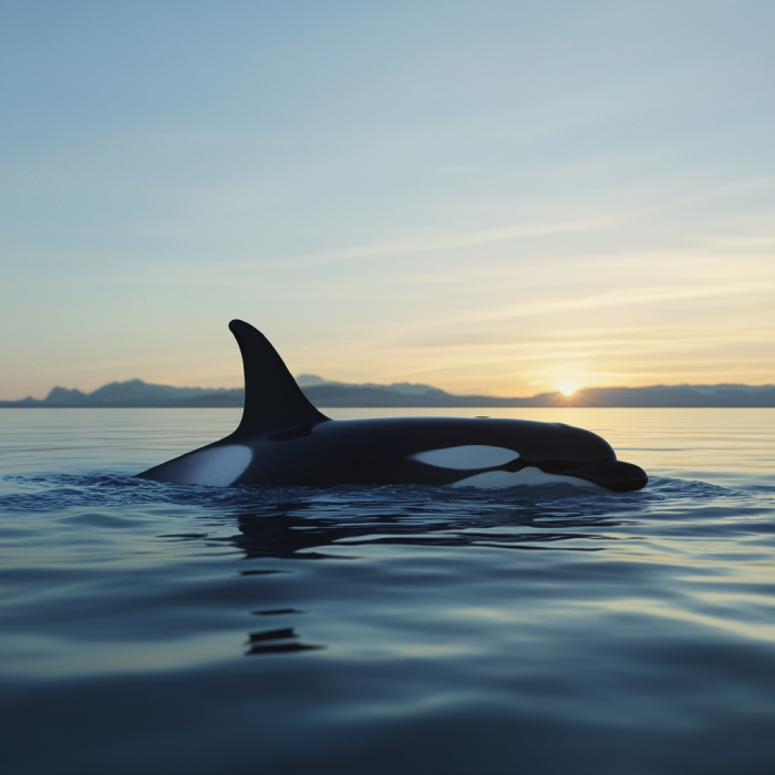
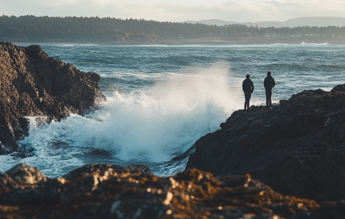
As one of the best tourist attractions of Sooke and Vancouver Island, West Coast comprises many outdoor excitements that cannot be denied. You are provided with different wildlife to watch and various food to eat, not to mention that you observe a rare nature that is outstanding. So, chances are high to see different whales and other marine creatures.
.webp)
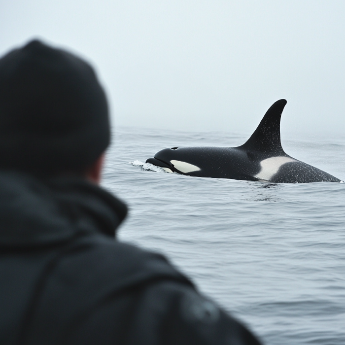
You would better plan a visit to Cabin Point Coastline between April-September. It is the best time for those preparing for Sooke Whale Watching in one of the famous coastlines for it in the Salish sea. You are given adequate opportunity to gaze upon these marvellous sea creatures.
.webp)
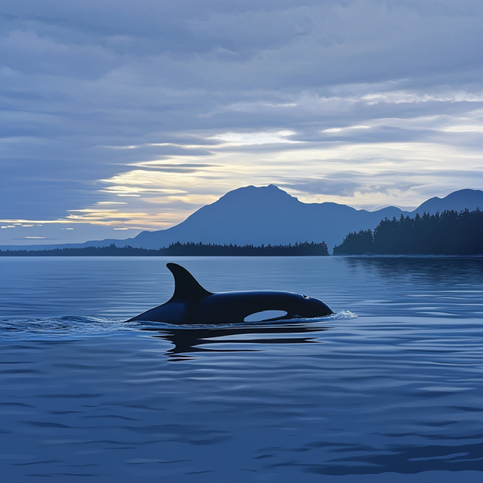
Beechey Head and its loop are two of the hot spots for whale watching in Sooke. In addition to fantastic opportunities for whale watching, Beechey Head is a hiking and nature trip location that offers you excellent activities, such as birdwatching.
.webp)
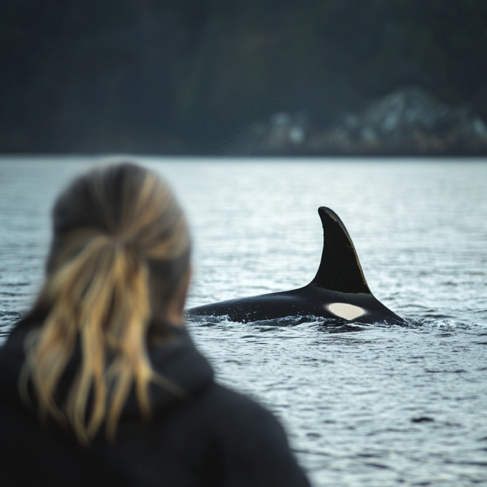
Spirit Bay has a rich community offering settlings for whale watching lovers beside incredible wildlife; therefore, it would be an excellent point to start your Sooke Whale Watching. Plus, it has a cute beach. You cannot get over the beauty of it and its scenic views.
Featuring wildflowers and fantastic sceneries, Creyke Point Trail is a suitable spot for whale watching, bird watching, and nature trips with splendid beaches and forests. So if you are having a great time in Sooke, remember to stop by Creyke Point to have more fun.
.webp)
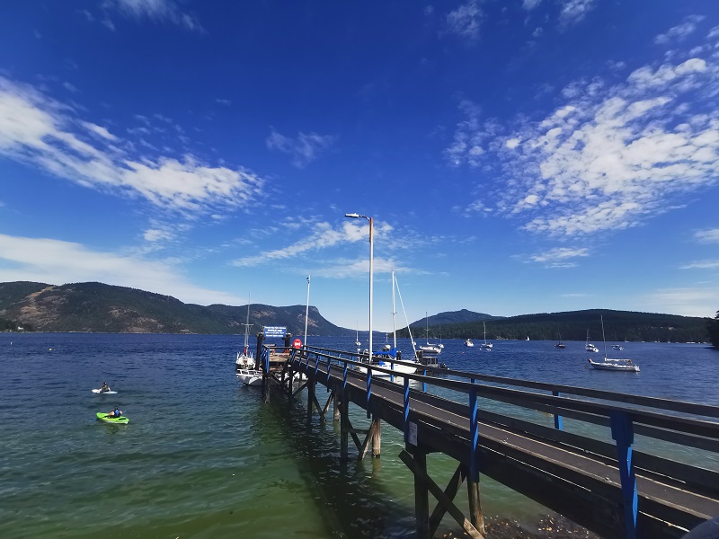
Located in the heart of Victoria and adjacent to many whale watching operators, Victoria Harbour Ferry is a starting point for your whale watching tour. Many visitors come here to watch whales annually; not only whale watching but open waterways of Salish make Victoria Harbour Ferry a remarkable place for anglers, wildlife followers and daily tourists.
Due to certified whale watching agencies, Fisherman's Wharf Park is a significant place to visit for whale watching enthusiasts. As one of the most prodigious and phenomenal creators worldwide, whales are ample during specific whale watching seasons.
Featuring Victoria Harbour and West Bay, Esquimalt could be your starting point for whale watching in Victoria. You can also have the pleasure of watching sea lions, seals, porpoises, and a wide variety of marine birds are other stunning creators that may be highly admirable to wildlife watching fanatics.
Cattle Point is a part of Uplands Park in Victoria, runs along the coastline of Oak Bay. During falls and winters, especially November through March, the Cattle Point Storm Watching is an exhilarating experience. Watch storms smashing from spectacular vantage points as dark clouds blanket the sky, rains whipping, gusts of winds making barreling high waves.


.webp)


Spiral Beach in Victoria is where the blue of the sea and sky and the Olympic Mountains at a distance is situated in a perfect picture. There are hills along the beach to stand on for a wide view. Walk on the sands and pebbles with the driftwoods around on the beach. Listen to the waves, walk on the shoreline, and have the storm watching pleasure in the fall and winter.
McNeill Bay has plenty of benches along the seawall to sit and enjoy the landscape of Trial Island, the Strait of Juan de Fuca, and Olympic Mountain. Do exciting water activities on McNeill Bay Beach and experience its wonderful esplanade and photogenic scenery. It is considered one of the fantastic off-leash dog beaches in Victoria.
Port Renfrew has been touted as "The Tall Tree Capital of Canada." It is also best known for its trails like Juan de Fuca Marine Trail and the historic West Coast Trail. Enjoy tens of kilometres of shorelines with amazing beaches. Fishing here is considered an opportunity for anglers. Port Renfrew is heaven for other water activities like whale watching, surfing, and kayaking.
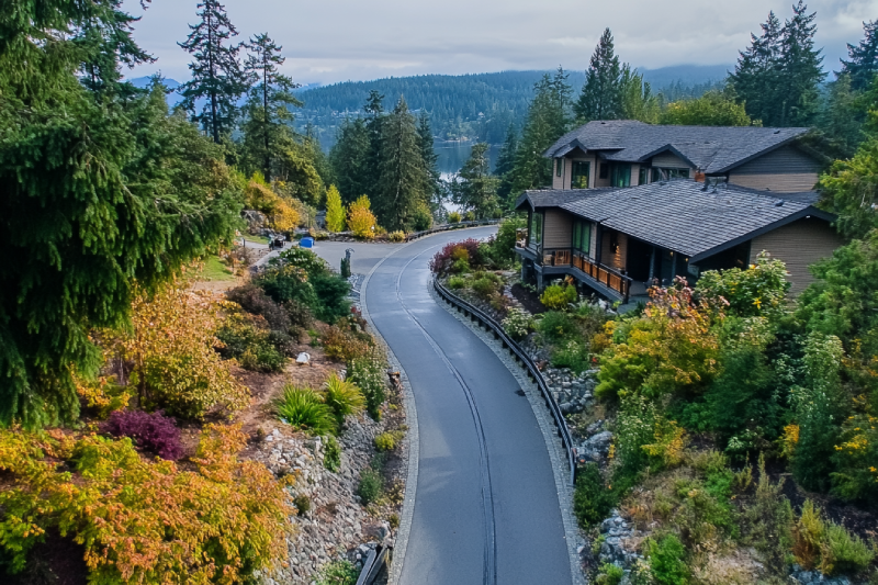
Langford is a city on the south coast of Vancouver Island and heaven for golfers. You can stay at lodgings and play at challenging hillside courses and enjoy yourself at luxurious advantages like the Amatista Spa. Beautiful parks surround the city, so go hiking through scenic forests or have peaceful moments beside lakes. Langford offers shops, family activities, sheep farms, and a bike park.
Gonzales Bay is a small scenic bay with a crescent-shaped beach. Its sandy beach is often quiet and peaceful. Walking on the Gonzales Bay beach near the ocean can help to release the world's anxiety. Lie on the beach and see the peaks of Olympic Mountain and enjoy the Mediterrane climate. Dogs are allowed off-leash on the beach from September through May.
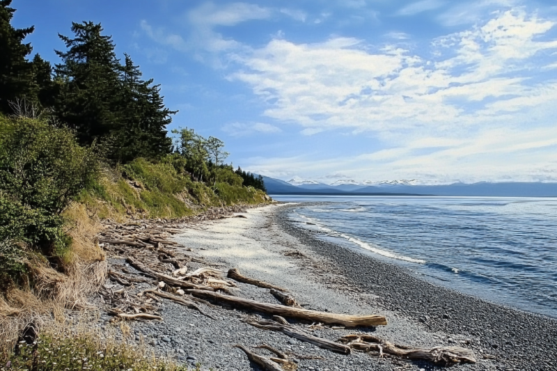
Jordan River is a small settlement famous among surfers. It has many tourist attractions like Hidden Falls, Mystic Beach and Mystic Falls, Sandcut Beach Waterfall and Sandcut Beach, China Beach, Juan de Fuca Trail Trailhead, and Jordan River Regional Park. Enjoy storm watching, kayaking, and Camping or have a picnic in the area, which could be an experience of a lifetime.
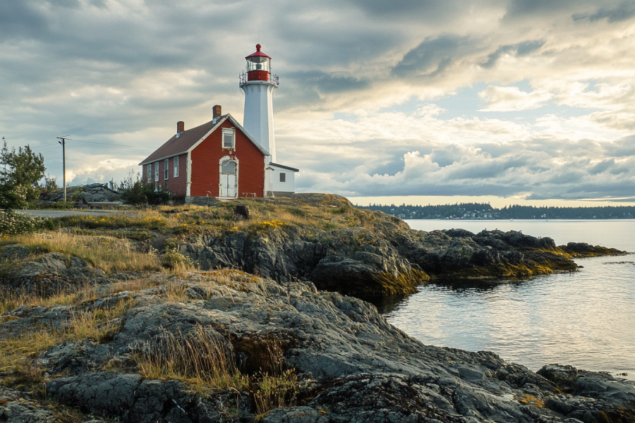
A trail leads you to Fisgard Lighthouse NHS, the first lighthouse on the west coast of Canada. This historic lighthouse is still operating, but the entrance is not allowed. The keeper's house is open to the public which comprises wonderful exhibitions. There you can see shipwrecks, far-flung lights, storms, and the working equipment the lightkeepers used about a century ago.
Sooke is known as the Tall Tree Capital of Canada. The area's popularity is mainly based on tourists visiting the wilderness parks, hiking the West Coast Trail and the extremely popular Juan de Fuca Marine Trail. Sooke is also famous for its beaches and is a destination for cycling and mountain biking. The arts community of Sooke is vibrant and hosts the annual Sooke Fine Arts Festival.
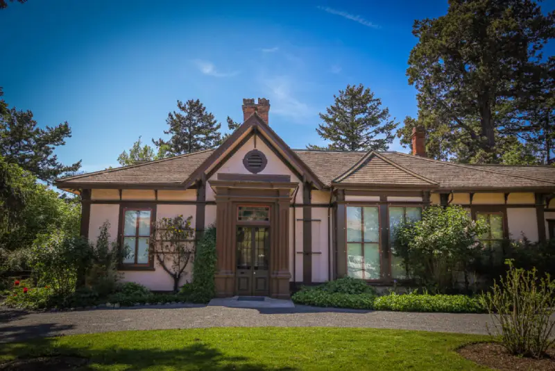
Point Ellice House Museum and Gardens is a place for history enthusiasts and gardens and interior design lovers. It is a 19th-century Victorian home and garden full of everything nostalgic to you. As one of Victoria's oldest homes, it is located overlooking the scenic and historic Selkirk Water/Gorge Waterway. It includes vegetables, cut flowers, a small fruit orchard, and a greenhouse.
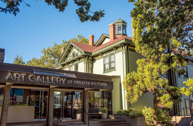
The Art Gallery of Greater Victoria or AGGV is home to artworks from talented artists of Canada and Asia. The building complex of the gallery includes the Spencer Mansion and the exhibition galleries. It also has gardens with a Japanese Shinto shrine. The art gallery is kid-friendly, and the staff is knowledgeable and helpful. The gift shop has gorgeous merchandise.

Located in Victoria, the Royal BC Museum is one of Canada's most significant cultural and historical treasures. It showcases natural wonders and includes artifacts, documents, specimens, and everything slightly relevant to British Columbia's natural and human history. The museum also provides a dynamic forum and a safe space for discussion and reflection.
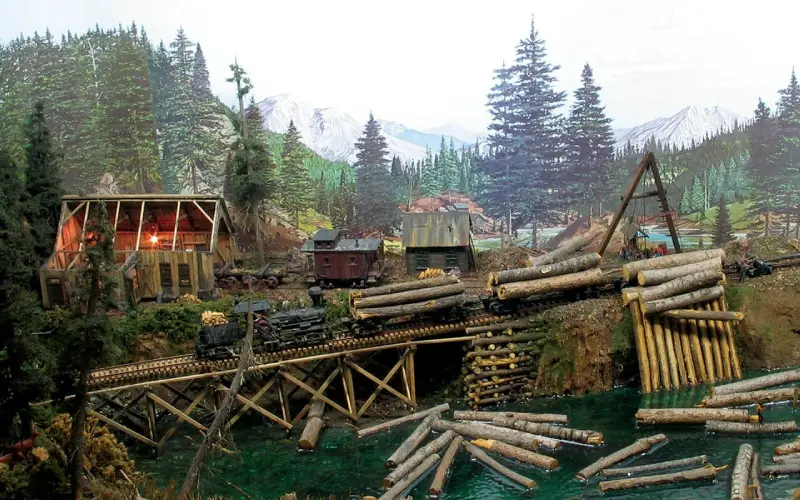
Miniature World is among the top ten attractions in Victoria. It is the World of Smallness, the World of Story Books, and the World of Fact, Fiction, and Fantasy. It presents villages with different themes such as Camelot or the World's Smallest Operational Sawmill or Space 2201 AD and Avian 1 Spaceship. Miniature World is so unique that you may want to visit it every time you're in Victoria.
If you are a fan of sun and beach, Victoria has the warmest weather in Canada to take a sunbath and swim, and Willows Beach is located in this area. This white sandy beach is south of Willows Park and has protected water suitable for a family vacation. Get the most out of your visit when you are at the park. Have a meal or drink in its cafe with a view of the sea.
Race Rocks Ecological Reserve was established to preserve intertidal and subtidal communities that became very rich due to strong tidal currents. It features marine mammals like whales, sea lions and seals, birds like ducks, cormorants, black oyster-catchers and bald eagles. Fish species, marine invertebrates, and animals like marine algae and seagrass are among other inhabitants.
Mystic Beach is placed between the Pacific Ocean and a forest. It gives you a mixture of land-based and water-based adventures. Marine animals, birds, Mystic Beach Waterfall, sunrise and sunset, are worthy of watching. Feel the beach by standing where the ocean kisses the shoreline and listen to the waves. Hiking on the beach and Juan De Fuca Marine Trail could be at the top of the list.